

There are no more items in your cart


C-Map REVEAL SOUTH & EAST AFRICA with Shaded Relief Marine Chart
R5,285.00
R5,020.75
Tax included
C-Map REVEAL C-Map REVEAL SOUTH & EAST AFRICA with Shaded Relief Marine Chart
Southern Angola to Oman
Area M-AF-Y209-MS
Includes 1st Year Update Subscription
On Micro sd Card
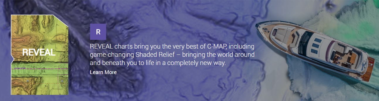
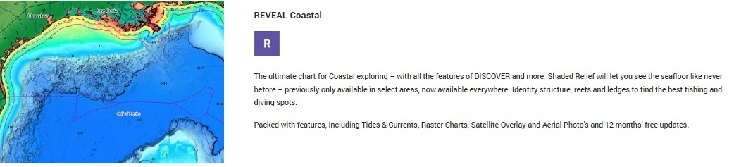
REVEAL charts bring you the very best of C-MAP, including Shaded Relief – bringing the world around and beneath you to life in a completely new way.
C-Map REVEAL C-Map REVEAL SOUTH & EAST AFRICA with Shaded Relief Marine Chart
Southern Angola to Oman
Area M-AF-Y209-MS
Including: Namibia, South Africa, Zimbabwe, Mozambique, Tanzania, Kenya, Comoros, Reunion, Madagascar, Mauritius
Includes 1st Year Update Subscription
On Micro sd Card
REVEAL charts bring you the very best of C-MAP, including Shaded Relief – bringing the world around and beneath you to life in a completely new way.
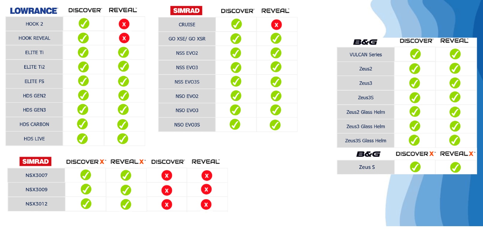
Compatible with HDS Pro, HDS Live, HDS Carbon, HDS Gen 3, Elite FS, Elite TI2 & Elite Ti
Not compatible with Eagle, Hook Reveal or Hook2.
Also Compatable with Certain SIMRAD & B&G Models
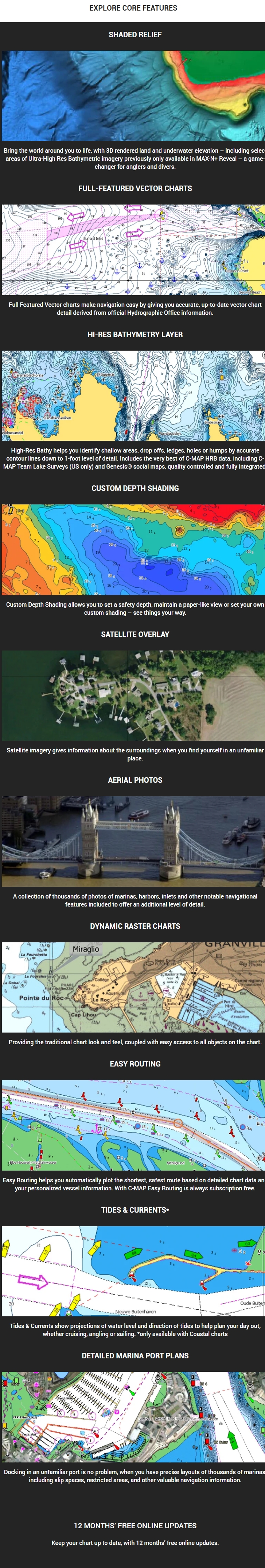
- Shaded Relief – bring the world around you to life, with 3D rendered land and underwater elevation – including areas of Ultra-High-Res Bathy seafloor imagery, previously only available in MAX-N+ Reveal – a game-changer for anglers.
- Full-Featured Vector Charts – making navigation easy by giving you accurate, up-to-date vector chart detail derive from official Hydrographic Office information.
- High-Res Bathy – helps you identify shallow areas, drop-offs, ledges, holes or humps. Now includes compiled and quality-controlled Genesis® detail as part of singular HRB layer.
- Custom Depth Shading – set a clear safety depth, maintain a paper-like view or create your own custom shading.
- Dynamic Raster Charts – providing the traditional chart look and feel, coupled with easy access to all objects on the chart.
- Easy Routing™ – helps you automatically plot the shortest, safest route based on detailed chart data and your personalized vessel information.
- Aerial Photography – a collection of thousands of photos of marinas, harbors, inlets and other notable navigational features included to offer an additional level of detail.
- Satellite Overlay – satellite imagery gives information about the surroundings when you find yourself in an unfamiliar place.
- Tides & Currents – shows projections of water level and direction of tides to help plan your day out, cruising, angling or sailing.
- Detailed Marina Port Plans – docking in an unfamiliar port is no problem when you have precise layouts of thousands of marinas, including slip spaces, restricted areas and other valuable navigation information.
- Harbor & Approach Details – unprecedented level of detail. Approach any harbor and inlet with confidence. The perfect conclusion to a long voyage, sailing adventure or an exciting day of fishing.
- Online Updates – keep your chart up to date, with 12 months’ free online updates.
CLICK HERE TO VIEW INTERACTIVE CHART VIEWER

NAVICO DEVICE COMPATABILITY LIST
LOWRANCE
B&G
SIMRAD
Reviews
No customer reviews for the moment.
You need to be logged in or create an account to give your appreciation of a review.