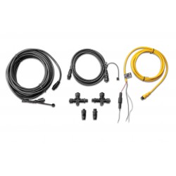
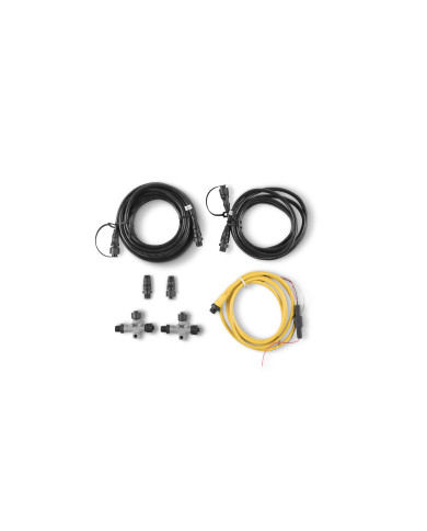
Garmin Marine Network Cable 12 m (40 Foot)
Large Waterproof Connectors
Garmin Marine Network Cable 152 m (500 Foot)
Large Waterproof Connectors
Garmin Marine Network Cable 1.8 m 6 m (20 Foot)
Large Waterproof Connectors
Garmin Marine Network Cable Coupler
Use our cable coupler to join two marine network cables end-to-end.
Garmin Marine Network Cable PoE Isolation Coupler
Garmin Marine Network to Garmin BlueNet network adapter cable
This Garmin BlueNet network adapter cable is often included with Panoptix™ transducers and sonar modules.
Garmin Mount Kit Only for Spy Pole Gesture Remote
This kit includes all mounting options for your Spy pole gesture remote, including a lanyard holder, hat mount and rod mounts.
Garmin MSC 10 Marine Satellite Compass
Black
Heading Sensor and Multi-band GPS Receiver
KNOW EXACTLY WHERE YOU'RE HEADED
Get reliable, accurate heading information with the easy-to-install GPS-based MSC™ 10 Marine Satellite Compass.
Garmin MSC 10 Marine Satellite Compass
White
Heading Sensor and Multi-band GPS Receiver
KNOW EXACTLY WHERE YOU'RE HEADED
Get reliable, accurate heading information with the easy-to-install GPS-based MSC™ 10 Marine Satellite Compass.
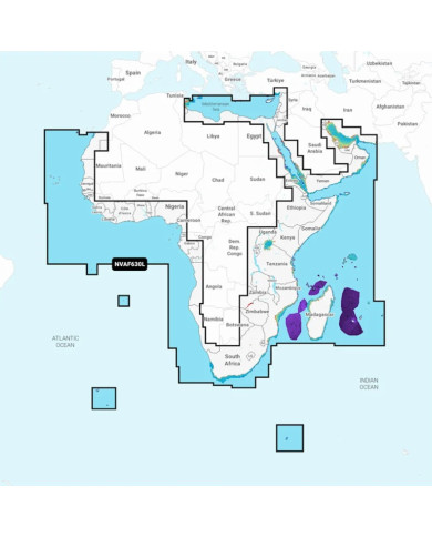
Africa & Middle East - Marine Charts
Garmin Navionics Vision+™ | NVAF630L | microSD™/SD™ and One-year Subscription
Detailed coverage of the coast of Africa and it's major inland lakes and Waterways and Middle East Excluding North & West Mediteranean Sea, including Indian Ocean & South Atlantic Ocean Islands.
Africa, East - Marine Charts
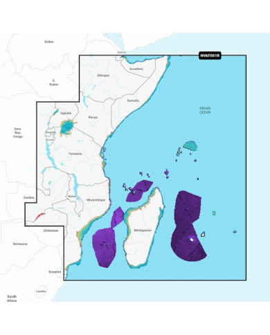
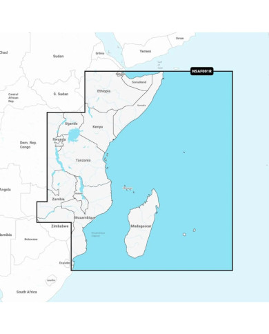
Garmin Navionics Vision+™ | NVAF001R | microSD™/SD™ and One-year Subscription
Coverage
Coastal coverage of the east coast of Africa from Maputo Bay to the Horn of Africa, Zanzibar, Madagascar, Mauritius, Reunion and the Seychelles
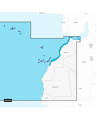
Africa North West - Marine Charts
Garmin Navionics Vision+™ | NVAF004R | microSD™/SD™ and One-year Subscription
Coverage
Coastal coverage of the northwest coast of Africa from St Louis, Senegal to Rabat, Morocco. Detailed coverage of the Azores, Madeira, the Canary Islands, the Cape Verde Islands and the ports of Rabat and Casablanca, Morocco are included.
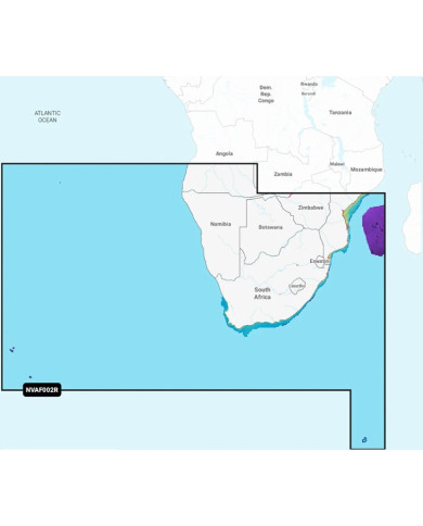
Africa Southern Coastal and Inland Charts
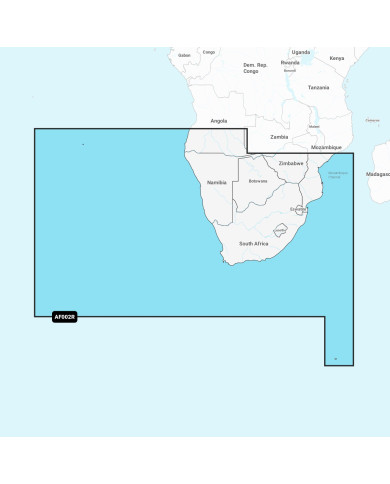
Garmin Navionics Vision+™ | NVAF002R | microSD™/SD™ and One-year Subscription
Detailed coverage of the coast of Southern Africa and it's major inland lakes and Waterways.... Namibe, Ang. to Angoche Island, Moz. Tristan da Cunha Islands, St. Helena Island and the Prince Edward Islands.
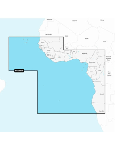
Africa West - Marine Charts
Garmin Navionics Vision+™ | NVAF005R | microSD™/SD™ and One-year Subscription
Coverage
Coastal coverage of the west coast of Africa from Dakar, Senegal to Cape Cross Bay, Namibia. Detailed coverage of the Cape Verde Islands, Sao Tome and Principe, St Helena Island and Ascension Island.
Parts of Zambezi River between Victoria Falls and Katima Mulilo.
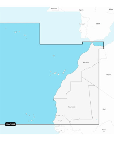
Africa, North West - Marine Charts
Garmin Navionics+™ | NSAF004R | microSD™/SD™ and One-year Subscription
Coastal coverage of the northwest coast of Africa from St Louis, Senegal to Rabat, Morocco. Detailed coverage of the Azores, Madeira, the Canary Islands, the Cape Verde Islands and the ports of Rabat and Casablanca, Morocco are included.
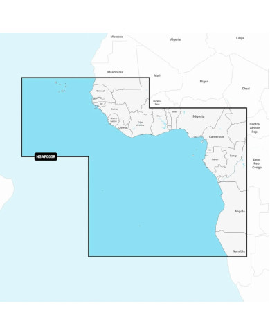
Africa, West - Marine Charts
Garmin Navionics+™ | NSAF05R | microSD™/SD™ and One-year Subscription
Coastal coverage of the west coast of Africa from Dakar, Senegal to Cape Cross Bay, Namibia. Detailed coverage of the Cape Verde Islands, Sao Tome and Principe, St Helena Island and Ascension Island and the ports of Dakar, Senegal; Lagos, Nigeria and Luanda, Angola are included.
Africa, East - Marine Charts
Garmin Navionics+™ | NSAF001R | microSD™/SD™ and One-year Subscription
Coastal coverage of the east coast of Africa from Maputo Bay to the Horn of Africa, Zanzibar, Madagascar, Mauritius, Reunion and the Seychelles.
Coverage includes the ports of Maputo, Mozambique; Dar es Salaam, Tanzania and Mombasa, & Lake Kariba
Garmin Navionics+ Southern Africa Coastal and Inland Charts
Garmin Navionics+™ | NSAF002R | microSD™/SD™ and One-year Subscription
Detailed coverage of the coast of Southern Africa and it's major inland lakes and Waterways.... Namibe, Ang. to Angoche Island, Moz. Tristan da Cunha Islands, St. Helena Island and the Prince Edward Islands.
Currently OUT OF STOCK - NEXT ETA NOVEMBER 2026.
Pre Paid Orders Welcome
Garmin NMEA 2000 - AIRMAR® DT800 (20° Tilt) Transducer
Garmin NMEA 2000® Multi-port T-connector, 4 Ports
Make NMEA 2000 installations easier with our multi-port T-connector. This solution creates a more robust NMEA 2000 backbone by reducing issues with breaking points as well as stress induced by long back bones. The rigid construction is less prone to failure and decreases installation time.
Garmin NMEA 2000® Backbone/Drop Cable Right Angle (2 m/6 ft)
Extend your NMEA 2000 backbone with our backbone/drop cables
Garmin NMEA 2000® Field-installable Connectors, Female
Use our male or female NMEA 2000 field-installable connectors to create custom-length drop cables and backbone extension cables. These connectors (sold separately) also can be used to shorten any NMEA 2000 drop/backbone cable.